Geolocate

Moratalaz topographic map

Click on the map to display elevation.

About this map

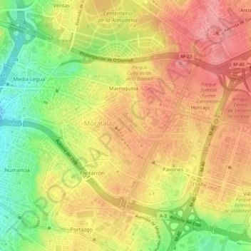
Name: Moratalaz topographic map, elevation, terrain.

Location: Moratalaz, Madrid, Community of Madrid, 28030, Spain (40.39256 -3.66539 40.41867 -3.62037)

Average elevation: 668 m

Minimum elevation: 601 m

Maximum elevation: 714 m

Other topographic maps

Click on a map to view its topography, its elevation and its terrain.

Madrid

Spain > Community of Madrid > Madrid

Average elevation: 650 m

Gear up for your next adventure:

🎒Hiking Daypack - Lightweight and durable backpacks for day trips and excursions
🧦Hiking Socks - Moisture-wicking and comfortable socks for long hikes
🧴Waterproofing Spray - Restore the DWR coating on jackets and tents
🧥Waterproof Pants - Keep dry during rainy hiking conditions
Camping Tent - Weather-resistant tents suitable for 2 to 6 people

As an Amazon Associate, this site earns from qualifying purchases at no extra cost to you.