
Thank you for supporting this site ❤️
Make a donation
Make a donation
Gear up for your next adventure:
As an Amazon Associate, this site earns from qualifying purchases at no extra cost to you.
Vispa topographic map
Click on the map to display elevation.
Thank you for supporting this site ❤️
Make a donation
Make a donation
Gear up for your next adventure:
As an Amazon Associate, this site earns from qualifying purchases at no extra cost to you.
About this map
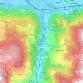
Name: Vispa topographic map, elevation, terrain.
Location: Vispa, Visperterminen, Visp, Wallis, 3934, Schweiz (46.23086 7.86974 46.30215 7.88239)
Average elevation: 1,319 m
Minimum elevation: 634 m
Maximum elevation: 2,260 m
Thank you for supporting this site ❤️
Make a donation
Make a donation
Gear up for your next adventure:
As an Amazon Associate, this site earns from qualifying purchases at no extra cost to you.