
Thank you for supporting this site ❤️
Make a donation
Make a donation
Gear up for your next adventure:
As an Amazon Associate, this site earns from qualifying purchases at no extra cost to you.
Sang'oro topographic map
Click on the map to display elevation.
Thank you for supporting this site ❤️
Make a donation
Make a donation
Gear up for your next adventure:
As an Amazon Associate, this site earns from qualifying purchases at no extra cost to you.
About this map
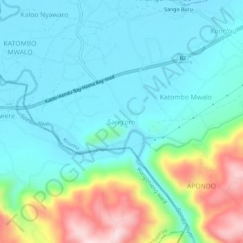
Name: Sang'oro topographic map, elevation, terrain.
Location: Sang'oro, West Nyakach ward, Nyakach, Kisumu County, Kenya (-0.37010 34.78848 -0.33010 34.82848)
Average elevation: 1,214 m
Minimum elevation: 1,135 m
Maximum elevation: 1,466 m
Thank you for supporting this site ❤️
Make a donation
Make a donation
Gear up for your next adventure:
As an Amazon Associate, this site earns from qualifying purchases at no extra cost to you.