
Thank you for supporting this site ❤️
Make a donation
Make a donation
Gear up for your next adventure:
As an Amazon Associate, this site earns from qualifying purchases at no extra cost to you.
Bertrand topographic map
Click on the map to display elevation.
Thank you for supporting this site ❤️
Make a donation
Make a donation
Gear up for your next adventure:
As an Amazon Associate, this site earns from qualifying purchases at no extra cost to you.
About this map
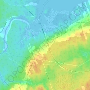
Name: Bertrand topographic map, elevation, terrain.
Average elevation: 12 m
Minimum elevation: -5 m
Maximum elevation: 32 m
Thank you for supporting this site ❤️
Make a donation
Make a donation
Gear up for your next adventure:
As an Amazon Associate, this site earns from qualifying purchases at no extra cost to you.
Other topographic maps
Click on a map to view its topography, its elevation and its terrain.
Maisonnette
Canada > Nouveau-Brunswick > Ville de Rivière-du-Nord > Paroisse de New Bandon
Average elevation: 2 m
Saint-Léolin
Canada > Nouveau-Brunswick > Ville de Rivière-du-Nord > Paroisse de New Bandon
Average elevation: 28 m