Geolocate

Melong topographic map

Click on the map to display elevation.

About this map

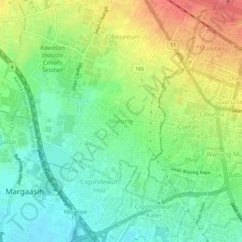
Name: Melong topographic map, elevation, terrain.

Location: Melong, Cimahi, West Java, Java, 40535, Indonesia (-6.93935 107.53820 -6.89935 107.57820)

Average elevation: 706 m

Minimum elevation: 679 m

Maximum elevation: 746 m

Other topographic maps

Click on a map to view its topography, its elevation and its terrain.

Cimahi

Indonesia > West Java > Cimahi > Baros

Average elevation: 715 m

Gear up for your next adventure:

🌡️Emergency Mylar Blankets - Compact thermal protection for unexpected nights outdoors
🛰️Satellite Messenger - Emergency communication for areas with no cell service
🧤Rechargeable Heated Gloves - Extreme warmth for Canadian winter expeditions
🔨Vehicle Emergency Tool - Safety tool for remote road trips to trailheads
🧶550 Survival Paracord - Versatile utility cord for emergency repairs and rigging

As an Amazon Associate, this site earns from qualifying purchases at no extra cost to you.