
Thank you for supporting this site ❤️
Make a donation
Make a donation
Gear up for your next adventure:
As an Amazon Associate, this site earns from qualifying purchases at no extra cost to you.
Sexsmith topographic map
Click on the map to display elevation.
Thank you for supporting this site ❤️
Make a donation
Make a donation
Gear up for your next adventure:
As an Amazon Associate, this site earns from qualifying purchases at no extra cost to you.
About this map
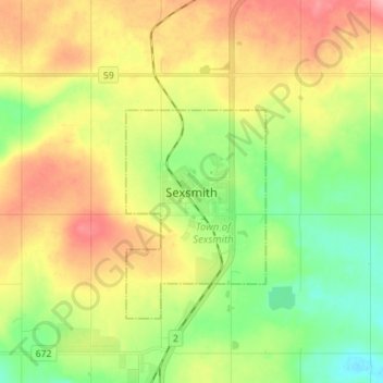
Name: Sexsmith topographic map, elevation, terrain.
Location: Sexsmith, Town of Sexsmith, Alberta, T0H 3C0, Canada (55.30970 -118.82386 55.38970 -118.74386)
Average elevation: 731 m
Minimum elevation: 686 m
Maximum elevation: 788 m
Town of Sexsmith trails, hiking, mountain biking, running and outdoor activities
Thank you for supporting this site ❤️
Make a donation
Make a donation
Gear up for your next adventure:
As an Amazon Associate, this site earns from qualifying purchases at no extra cost to you.