

Betanzos topographic map
Click on the map to display elevation.
Betanzos
Calunio as a toponym fits well as an evolution of "calunia" the place where calumny somehow was associated to, for example a few fishermen depicting their fishery within some augmentation. When the hamlet step up to the village status claims for a more feasible official name would stand aiming its elevation purposes . Betar which means to match the colors, for example when making fashionable cloths, used figuratively as to say well or agree, was the antonym picked down to replace the previous form of nominate the place. Within the betar family of words, betanços would apply better for the double function of invert the context (without distort the action of have been saying something in it superlative acception) and to be suitable as a toponym where Betanzos is its latest form.
About this map
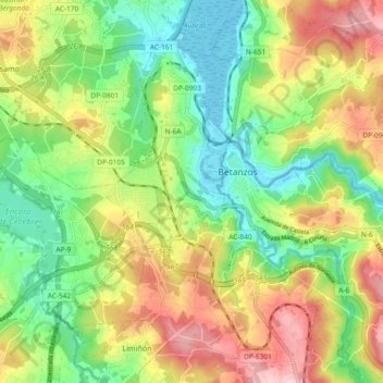
Name: Betanzos topographic map, elevation, terrain.
Location: Betanzos, A Coruña, Galicia, Spain (43.24608 -8.27145 43.30541 -8.17840)
Average elevation: 93 m
Minimum elevation: -2 m
Maximum elevation: 223 m