Geolocate

Tetbury topographic map

Click on the map to display elevation.

About this map
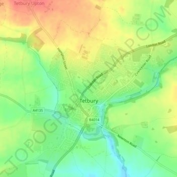
Name: Tetbury topographic map, elevation, terrain.

Location: Tetbury, Cotswold District, Gloucestershire, England, United Kingdom (51.63063 -2.16974 51.65158 -2.14202)

Average elevation: 122 m

Minimum elevation: 91 m

Maximum elevation: 156 m

Other topographic maps

Click on a map to view its topography, its elevation and its terrain.
Gear up for your next adventure:

💧Reusable Water Bottle - Durable water bottles for hydration on trails
🔦LED Flashlight - Powerful and long-lasting flashlight for camping and emergencies
🥾Mountain Trail Shoes - High-traction shoes for mountain trails
🛶Kayak Dry Bag - Waterproof storage for kayaking adventures
🥾Durable Hiking Shoes - Long-lasting shoes for frequent hiking

As an Amazon Associate, this site earns from qualifying purchases at no extra cost to you.