Geolocate

Ubrique topographic map

Click on the map to display elevation.

About this map
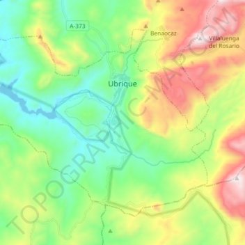
Name: Ubrique topographic map, elevation, terrain.

Location: Ubrique, Sierra de Cádiz, Cádiz, Andalusia, 11600, Spain (36.61417 -5.53982 36.70259 -5.39581)

Average elevation: 612 m

Minimum elevation: 205 m

Maximum elevation: 1,384 m

Gear up for your next adventure:

🥾Hiking Leggings - Comfortable leggings for outdoor activities
👖Convertible Hiking Pants - Zip-off legs to adapt to changing weather conditions
⛺Camping Tent - Weather-resistant tents suitable for 2 to 6 people
🧢Outdoor Visor - Breathable visor for sunny hikes
🧰Multitool Knife - Compact and versatile tool for outdoor use

As an Amazon Associate, this site earns from qualifying purchases at no extra cost to you.