
Thank you for supporting this site ❤️
Make a donation
Make a donation
Gear up for your next adventure:
As an Amazon Associate, this site earns from qualifying purchases at no extra cost to you.
Kangoo topographic map
Click on the map to display elevation.
Thank you for supporting this site ❤️
Make a donation
Make a donation
Gear up for your next adventure:
As an Amazon Associate, this site earns from qualifying purchases at no extra cost to you.
About this map
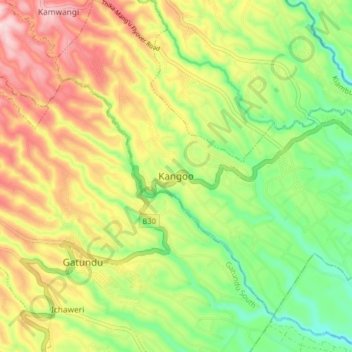
Name: Kangoo topographic map, elevation, terrain.
Location: Kangoo, Mang'u ward, Gatundu North, Kiambu, 01030, Kenya (-1.03599 36.88702 -0.95599 36.96702)
Average elevation: 1,657 m
Minimum elevation: 1,538 m
Maximum elevation: 1,799 m
Thank you for supporting this site ❤️
Make a donation
Make a donation
Gear up for your next adventure:
As an Amazon Associate, this site earns from qualifying purchases at no extra cost to you.