Geolocate

Yeton topographic map

Click on the map to display elevation.

About this map

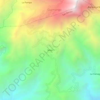
Name: Yeton topographic map, elevation, terrain.

Location: Yeton, San Benito, Contumazá, Cajamarca, Perú (-7.42126 -78.91811 -7.38126 -78.87811)

Average elevation: 1,997 m

Minimum elevation: 1,344 m

Maximum elevation: 3,000 m

Gear up for your next adventure:

👟Trail Running Shoes - Agile footwear for fast-paced topographic exploration
💡Portable Camping Lamp - Rechargeable lamp for campsite lighting
🥾Trekking Poles - Adjustable trekking poles to reduce knee stress and improve stability
🔦LED Flashlight - Powerful and long-lasting flashlight for camping and emergencies
🥾Mountain Hiking Shoes - Shoes with superior grip for mountainous terrain

As an Amazon Associate, this site earns from qualifying purchases at no extra cost to you.