
Thank you for supporting this site ❤️
Make a donation
Make a donation
Gear up for your next adventure:
As an Amazon Associate, this site earns from qualifying purchases at no extra cost to you.
Moonanakuzhy topographic map
Click on the map to display elevation.
Thank you for supporting this site ❤️
Make a donation
Make a donation
Gear up for your next adventure:
As an Amazon Associate, this site earns from qualifying purchases at no extra cost to you.
About this map
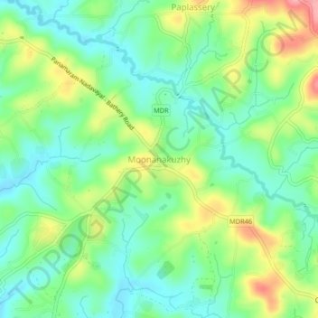
Name: Moonanakuzhy topographic map, elevation, terrain.
Location: Moonanakuzhy, Sulthanbathery, Wayanad, Kerala, 673591, India (11.67987 76.16487 11.71987 76.20487)
Average elevation: 784 m
Minimum elevation: 745 m
Maximum elevation: 856 m
Thank you for supporting this site ❤️
Make a donation
Make a donation
Gear up for your next adventure:
As an Amazon Associate, this site earns from qualifying purchases at no extra cost to you.