Geolocate

Dawe topographic map

Click on the map to display elevation.

About this map

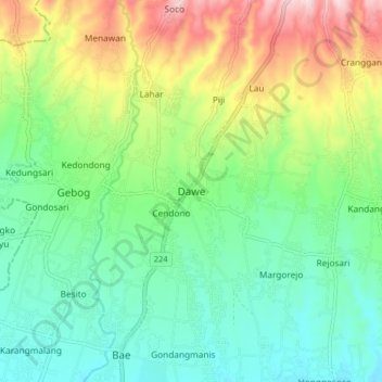
Name: Dawe topographic map, elevation, terrain.

Location: Dawe, Kudus, Central Java, Java, 59354, Indonesia (-6.77493 110.82896 -6.69493 110.90896)

Average elevation: 144 m

Minimum elevation: 30 m

Maximum elevation: 379 m

Gear up for your next adventure:

🦌Outdoor Trail Camera - Monitor wildlife activity near your favorite spots
🔥Camping Stove - Portable stoves to cook outdoors with ease
🧭GPS Outdoor Watch - Smart watch for navigation and fitness tracking in nature
🪑Ultralight Camping Stool - Compact seating for rest stops during long hikes
🥾Hiking Boots - Sturdy boots providing ankle support and traction on rugged trails

As an Amazon Associate, this site earns from qualifying purchases at no extra cost to you.