Geolocate

Susut topographic map

Click on the map to display elevation.

About this map

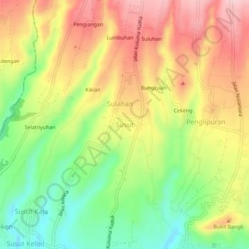
Name: Susut topographic map, elevation, terrain.

Location: Susut, Bangli, Bali, Lesser Sunda Islands, 80613, Indonesia (-8.44235 115.32550 -8.40235 115.36550)

Average elevation: 545 m

Minimum elevation: 428 m

Maximum elevation: 661 m

Gear up for your next adventure:

🥾Trail Running Boots - Durable shoes designed for trail running
🥾Trail Hiking Socks - Comfortable socks to prevent blisters and fatigue
🧦Hiking Socks - Moisture-wicking and comfortable socks for long hikes
🥾Hiking Shorts - Breathable shorts suitable for summer hikes
🕶️Polarized Sunglasses - Reduces glare from snow and water at high elevations

As an Amazon Associate, this site earns from qualifying purchases at no extra cost to you.