Geolocate

Saint-Constant topographic map

Click on the map to display elevation.

About this map

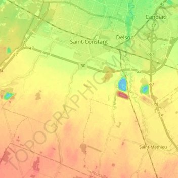
Name: Saint-Constant topographic map, elevation, terrain.

Location: Saint-Constant, Roussillon, Montérégie, Quebec, Canada (45.29562 -73.66055 45.39536 -73.51618)

Average elevation: 37 m

Minimum elevation: -12 m

Maximum elevation: 63 m

Roussillon trails, hiking, mountain biking, running and outdoor activities

Gear up for your next adventure:

🛁Quick-Dry Microfiber Towel - Space-saving towel that dries rapidly on the move
🧥Thermal Fleece Jacket - Versatile insulation for changing mountain temperatures
🧦Crew Hiking Socks - Comfortable socks for long-distance hikes
🧥Fleece Jacket - Warm and lightweight jacket for layering
🧭GPS Tracker - Track your location in remote areas safely

As an Amazon Associate, this site earns from qualifying purchases at no extra cost to you.