
Capri topographic map
Click on the map to display elevation.
About this map
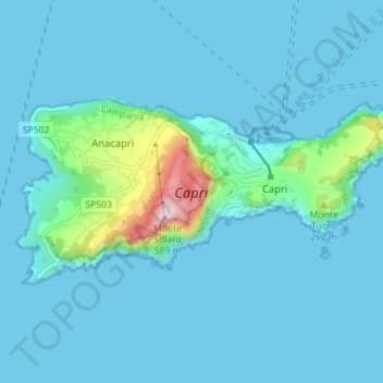
Name: Capri topographic map, elevation, terrain.
Location: Capri, Anacapri, Naples, Campania, Italy (40.53588 14.19576 40.56185 14.26638)
Average elevation: 55 m
Minimum elevation: -1 m
Maximum elevation: 570 m
Other topographic maps
Click on a map to view its topography, its elevation and its terrain.
Monte Solaro
Italy > Campania > Naples > Anacapri
Monte Solaro is a mountain on the island of Capri in Campania, Italy. With an elevation of 589 m, its peak is the highest point of Capri.
Average elevation: 155 m