Geolocate

Calatagan topographic map

Click on the map to display elevation.

About this map

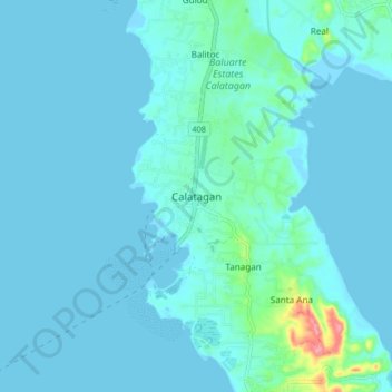
Name: Calatagan topographic map, elevation, terrain.

Location: Calatagan, Batangas, Calabarzon, 4215, Philippines (13.79299 120.59224 13.87299 120.67224)

Average elevation: 9 m

Minimum elevation: -3 m

Maximum elevation: 99 m

Gear up for your next adventure:

🧴Outdoor Sunscreen - High SPF protection for high-altitude UV exposure
🥫Freeze-Dried Meals - Lightweight, high-calorie nutrition for multi-day treks
🥾Lightweight Hiking Boots - Boots for comfort and mobility on long hikes
🏕️Camping Hammock - Integrated protection for sleeping between trees
🦯Trekking Poles - Reduced impact on joints for steep topographic climbs

As an Amazon Associate, this site earns from qualifying purchases at no extra cost to you.