Geolocate

San Simone topographic map

Click on the map to display elevation.

About this map

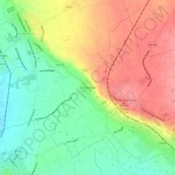
Name: San Simone topographic map, elevation, terrain.

Location: San Simone, Sannicola, Lecce, Puglia, 73058, Italia (40.06193 18.06192 40.10193 18.10192)

Average elevation: 88 m

Minimum elevation: 44 m

Maximum elevation: 135 m

Gear up for your next adventure:

🥾All-Terrain Hiking Boots - Versatile boots for varied hiking conditions
🧊Portable Cooler - Keep food and drinks cold during outdoor adventures
🏃Hydration Running Vest - Carry water and maps close to your body for speed
🔦UV Flashlight - Detect minerals or specific insects in the dark
🛶Kayak Dry Bag - Waterproof storage for kayaking adventures

As an Amazon Associate, this site earns from qualifying purchases at no extra cost to you.