

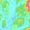
High Mountain topographic map
Click on the map to display elevation.
About this map
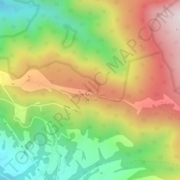
Name: High Mountain topographic map, elevation, terrain.
Location: High Mountain, Randolph County, West Virginia, United States (38.91839 -79.47538 38.91849 -79.47528)
Average elevation: 1,118 m
Minimum elevation: 836 m
Maximum elevation: 1,432 m
Other topographic maps
Click on a map to view its topography, its elevation and its terrain.

Elkins
United States > West Virginia > Randolph County
Elkins is located at the confluence of the Tygart Valley River and Leading Creek. The average elevation is 2,000 feet (610 m) above sea level. According to the United States Census Bureau, the city has a total area of 3.43 square miles (8.88 km2), all land. Elkins is headquarters for the Monongahela National…
Average elevation: 637 m


Spruce Knob Lake
United States > West Virginia > Randolph County
Spruce Knob Lake is a 23-acre (0.093 km2) reservoir located within the Monongahela National Forest in Randolph County, West Virginia, USA. The recreation area surrounding Spruce Knob Lake contains camping and picnicking facilities as well as a boating site. At an elevation of 3,840 feet, it is the highest lake…
Average elevation: 1,204 m