
Thank you for supporting this site ❤️
Make a donation
Make a donation
Gear up for your next adventure:
As an Amazon Associate, this site earns from qualifying purchases at no extra cost to you.
Onkeljoch topographic map
Click on the map to display elevation.
Thank you for supporting this site ❤️
Make a donation
Make a donation
Gear up for your next adventure:
As an Amazon Associate, this site earns from qualifying purchases at no extra cost to you.
About this map
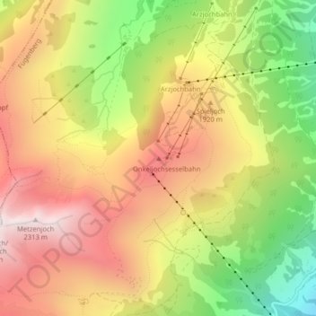
Name: Onkeljoch topographic map, elevation, terrain.
Location: Onkeljoch, Fügenberg, Bezirk Schwaz, Tirol, 6264, Österreich (47.32550 11.79160 47.32560 11.79170)
Average elevation: 1,740 m
Minimum elevation: 1,094 m
Maximum elevation: 2,293 m
Thank you for supporting this site ❤️
Make a donation
Make a donation
Gear up for your next adventure:
As an Amazon Associate, this site earns from qualifying purchases at no extra cost to you.