Geolocate

Gurpa topographic map

Click on the map to display elevation.

About this map

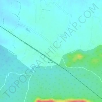
Name: Gurpa topographic map, elevation, terrain.

Location: Gurpa, Fatehpur, Gaya, Bihar, India (24.55376 85.28874 24.57376 85.30874)

Average elevation: 189 m

Minimum elevation: 174 m

Maximum elevation: 254 m

Gear up for your next adventure:

🛶Kayak Dry Bag - Waterproof storage for kayaking adventures
🛏️Camping Sleeping Mat - Comfortable mats for sleeping outdoors
🔋Lithium AA Batteries - Long-lasting power that performs in extreme cold
💧Reusable Water Bottle - Durable water bottles for hydration on trails
💧Filtered Water Bottle - Safe drinking water on the go

As an Amazon Associate, this site earns from qualifying purchases at no extra cost to you.