Geolocate

Athens Township topographic map

Click on the map to display elevation.

About this map
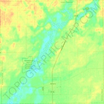
Name: Athens Township topographic map, elevation, terrain.

Location: Athens Township, Calhoun County, Michigan, 49011, United States (42.07161 -85.29540 42.15944 -85.17676)

Average elevation: 274 m

Minimum elevation: 257 m

Maximum elevation: 290 m

Other topographic maps

Click on a map to view its topography, its elevation and its terrain.

Gear up for your next adventure:

🔭Compact Monocular - One-handed bird watching and trail spotting
⛺Backpacking Tent - Lightweight tent for long-distance hiking trips
🧴First Aid Kit - Essential first aid supplies for outdoor emergencies
🧴Bear Spray Holster - Quick-access carry for essential Canadian wilderness safety
🔨Vehicle Emergency Tool - Safety tool for remote road trips to trailheads

As an Amazon Associate, this site earns from qualifying purchases at no extra cost to you.