
Thank you for supporting this site ❤️
Make a donation
Make a donation
Gear up for your next adventure:
As an Amazon Associate, this site earns from qualifying purchases at no extra cost to you.
Limbangan topographic map
Click on the map to display elevation.
Thank you for supporting this site ❤️
Make a donation
Make a donation
Gear up for your next adventure:
As an Amazon Associate, this site earns from qualifying purchases at no extra cost to you.
About this map
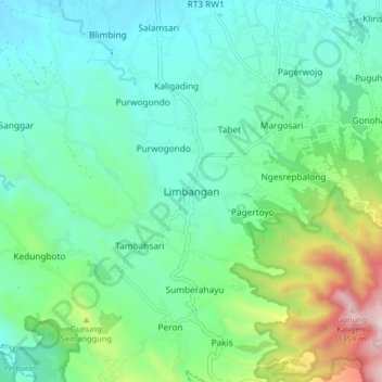
Name: Limbangan topographic map, elevation, terrain.
Location: Limbangan, Kendal, Central Java, Java, 51381, Indonesia (-7.19004 110.24532 -7.11004 110.32532)
Average elevation: 540 m
Minimum elevation: 278 m
Maximum elevation: 1,381 m
Thank you for supporting this site ❤️
Make a donation
Make a donation
Gear up for your next adventure:
As an Amazon Associate, this site earns from qualifying purchases at no extra cost to you.