Geolocate

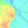
Purovsky Rayon topographic map

Click on the map to display elevation.

About this map

Name: Purovsky Rayon topographic map, elevation, terrain.

Location: Purovsky Rayon, Yamalo-Nenets Autonomous Okrug, Ural Federal District, Russia (62.46410 73.05363 67.75556 80.83238)

Average elevation: 60 m

Minimum elevation: -3 m

Maximum elevation: 249 m

Other topographic maps

Click on a map to view its topography, its elevation and its terrain.

Gear up for your next adventure:

🔋Emergency Crank Radio - Weather alerts and power without needing batteries
🧥Thermal Layer - Insulating layer for cold outdoor conditions
👟Sport Hiking Sandals - Breathable footwear for water crossings and camp rest
🛌Insulated Sleeping Pad - Critical thermal barrier between you and the cold ground
🚲Heavy Duty Bike Lock - Secure your bike at the trailhead or during stops

As an Amazon Associate, this site earns from qualifying purchases at no extra cost to you.