Geolocate

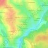
Le Haut Domin topographic map

Click on the map to display elevation.

About this map

Name: Le Haut Domin topographic map, elevation, terrain.

Location: Le Haut Domin, Le Bourgneuf-la-Forêt, Laval, Mayenne, Pays de la Loire, France métropolitaine, 53410, France (48.13397 -0.99010 48.17397 -0.95010)

Average elevation: 147 m

Minimum elevation: 112 m

Maximum elevation: 189 m

Other topographic maps

Click on a map to view its topography, its elevation and its terrain.
Gear up for your next adventure:

🧤Rechargeable Heated Gloves - Extreme warmth for Canadian winter expeditions
🔦LED Headlamp - Hands-free lighting for early morning starts or late finishes
🥾Waterproof Trail Shoes - Shoes designed to handle wet terrain
🛶Waterproof Dry Bags - Keep electronics and clothes dry during river crossings
🧰Emergency Multi-Tool - Compact multi-tool for outdoor survival

As an Amazon Associate, this site earns from qualifying purchases at no extra cost to you.