Geolocate

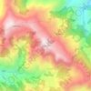
Chapakot topographic map

Click on the map to display elevation.

About this map

Name: Chapakot topographic map, elevation, terrain.

Location: Chapakot, Syangja, Gandaki Province, Nepal (27.86777 83.75048 27.97981 83.96091)

Average elevation: 803 m

Minimum elevation: 310 m

Maximum elevation: 1,676 m

Other topographic maps

Click on a map to view its topography, its elevation and its terrain.

Rangkhola Bazar

Nepal > Gandaki Province > Syangja

Average elevation: 1,009 m

Putalibazar

Nepal > Gandaki Province > Syangja

Average elevation: 1,093 m

Nagdanda

Nepal > Gandaki Province > Syangja

Average elevation: 1,052 m

Wāling

Nepal > Gandaki Province > Syangja

Waling Municipality experiences a subtropical highland climate, characteristic of the hilly regions of Nepal. The climate in Waling is influenced by its varying elevation, ranging from 731 meters to 1,600 meters above sea level.

Average elevation: 969 m

Seti Khola

Nepal > Gandaki Province > Syangja

Average elevation: 989 m

Budhakot

Nepal > Gandaki Province > Syangja > Yaladi

Average elevation: 1,242 m

Kalikakot

Nepal > Gandaki Province > Syangja

Average elevation: 1,328 m

Pelakot

Nepal > Gandaki Province > Syangja

Average elevation: 1,112 m

Kalikakot

Nepal > Gandaki Province > Syangja

Average elevation: 1,328 m

sepat village

Nepal > Gandaki Province > Syangja

Average elevation: 1,216 m

Gear up for your next adventure:

🥾Waterproof Hiking Boots - Boots keeping your feet dry in wet conditions
🥾Hiking Boots - Sturdy boots providing ankle support and traction on rugged trails
🥾Mountain Trail Shoes - High-traction shoes for mountain trails
🧢Beanie Hat - Keep your head warm in cold weather
🎒Hiking Daypack - Lightweight and durable backpacks for day trips and excursions

As an Amazon Associate, this site earns from qualifying purchases at no extra cost to you.