Geolocate

Bacai topographic map

Click on the map to display elevation.

About this map

Name: Bacai topographic map, elevation, terrain.

Location: Bacai, Baise, Guangxi, China (24.87836 106.60280 24.91836 106.64280)

Average elevation: 926 m

Minimum elevation: 779 m

Maximum elevation: 1,141 m

Other topographic maps

Click on a map to view its topography, its elevation and its terrain.
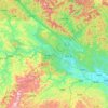
Youjiang District

China > Guangxi > Baise

Average elevation: 532 m

Gear up for your next adventure:

🧢Sun Protection Cap - Breathable cap to protect from sun exposure
🎒Backpack Rain Cover - External shield to keep your entire pack dry
🦯Trekking Poles - Reduced impact on joints for steep topographic climbs
🧢Hiking Sun Hat - Wide-brimmed protection for exposed mountain ridges
🥾Trail Running Shoes - Lightweight and durable shoes for trail running

As an Amazon Associate, this site earns from qualifying purchases at no extra cost to you.