Geolocate

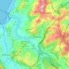
Valcovo topographic map

Click on the map to display elevation.

About this map

Name: Valcovo topographic map, elevation, terrain.

Location: Valcovo, Arteixo, La Coruña, Galicia, 15142, España (43.29498 -8.54985 43.33498 -8.50985)

Average elevation: 39 m

Minimum elevation: 0 m

Maximum elevation: 238 m

Other topographic maps

Click on a map to view its topography, its elevation and its terrain.

Loureda

España > Galicia > La Coruña > Arteixo

Average elevation: 183 m

Oseiro

España > Galicia > La Coruña > Arteixo

Average elevation: 80 m

Pastoriza

España > Galicia > La Coruña > Arteixo

Average elevation: 104 m

Morás

España > Galicia > La Coruña > Arteixo

Average elevation: 135 m

Gear up for your next adventure:

🪑Insulated Seat Pad - Protect your seat from cold rocks and wet logs
🛏️Sleeping Bag - Warm and compact sleeping bags for outdoor camping
🥾Trekking Poles - Adjustable trekking poles to reduce knee stress and improve stability
🕶️Polarized Sunglasses - Reduces glare from snow and water at high elevations
⛺Backpacking Tent - Lightweight tent for long-distance hiking trips

As an Amazon Associate, this site earns from qualifying purchases at no extra cost to you.