Geolocate

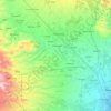
Maligo topographic map

Click on the map to display elevation.

About this map

Name: Maligo topographic map, elevation, terrain.

Location: Maligo, Polomolok, South Cotabato, Soccsksargen, Philippines (6.28350 125.11459 6.32350 125.15459)

Average elevation: 636 m

Minimum elevation: 474 m

Maximum elevation: 906 m

Other topographic maps

Click on a map to view its topography, its elevation and its terrain.
Silway River

Philippines > South Cotabato > Polomolok

Average elevation: 257 m

Gear up for your next adventure:

🗺️Topographic Maps - Detailed maps to explore trails, mountains, and wilderness areas
🛏️Camping Sleeping Mat - Comfortable mats for sleeping outdoors
🥤Collapsible Travel Cup - Saves space and weight in your mess kit
🎒Backpack Rain Cover - External shield to keep your entire pack dry
🥘Camping Cookware Set - Compact nesting pots and pans for trail cooking

As an Amazon Associate, this site earns from qualifying purchases at no extra cost to you.