
Make a donation
Gear up for your next adventure:
As an Amazon Associate, this site earns from qualifying purchases at no extra cost to you.
Haus der Flüsse topographic map
Click on the map to display elevation.
Make a donation
Gear up for your next adventure:
As an Amazon Associate, this site earns from qualifying purchases at no extra cost to you.
About this map
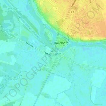
Name: Haus der Flüsse topographic map, elevation, terrain.
Average elevation: 31 m
Minimum elevation: 22 m
Maximum elevation: 52 m
Make a donation
Gear up for your next adventure:
As an Amazon Associate, this site earns from qualifying purchases at no extra cost to you.
Other topographic maps
Click on a map to view its topography, its elevation and its terrain.
Make a donation
Gear up for your next adventure:
As an Amazon Associate, this site earns from qualifying purchases at no extra cost to you.
Warnau
Deutschland > Sachsen-Anhalt > Stendal > Havelberg
Die ursprüngliche wendische Ansiedlung lag westlich vom heutigen Warnau, an der Straße von Rehberg kommend links. Da diese Flächen oft vom Hochwasser überschwemmt werden, wurde das Dorf auf einer Anhöhe neu errichtet. Wann genau die Verlegung erfolgte, ist nicht bekannt, vermutet wird die Zeit nach dem…
Average elevation: 27 m