Geolocate

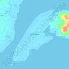
Quiniput topographic map

Click on the map to display elevation.

About this map

Name: Quiniput topographic map, elevation, terrain.

Location: Quiniput, Zamboanga City, Zamboanga Peninsula, 7000, Philippines (7.15831 122.20095 7.19831 122.24095)

Average elevation: 70 m

Minimum elevation: -3 m

Maximum elevation: 269 m

Other topographic maps

Click on a map to view its topography, its elevation and its terrain.

Sacol Island

Philippines > Zamboanga City

Average elevation: 6 m

Vitali River

Philippines > Zamboanga City > Mangusu

Average elevation: 27 m

Sinunug Island

Philippines > Zamboanga City

Average elevation: 0 m

Plaza Pershing

Philippines > Zamboanga City

Average elevation: 4 m

Gear up for your next adventure:

🗺️Topographic Maps - Detailed maps to explore trails, mountains, and wilderness areas
🦟Insect Repellent - Keep mosquitoes and black flies away in wooded areas
❄️Traction Ice Cleats - Slip-on spikes for icy trails and winter hiking
⛺Bushcraft Tarp - Versatile emergency shelter or gear protection
🥽Outdoor Goggles - Protective eyewear for outdoor activities

As an Amazon Associate, this site earns from qualifying purchases at no extra cost to you.