Geolocate

Meijiao topographic map

Click on the map to display elevation.

About this map

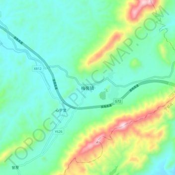
Name: Meijiao topographic map, elevation, terrain.

Location: Meijiao, Xingguo County, Ganzhou, Jiangxi, China (26.36000 115.71855 26.44000 115.79855)

Average elevation: 373 m

Minimum elevation: 228 m

Maximum elevation: 796 m

Gear up for your next adventure:

🧭GPS Outdoor Watch - Smart watch for navigation and fitness tracking in nature
🐕Hiking Dog Pack - Let your canine companion carry their own water and food
🛁Quick-Dry Microfiber Towel - Space-saving towel that dries rapidly on the move
Lightweight Backpacking Tent - Compact tent for efficient hiking trips
🌬️Windproof Camp Stove - Efficient cooking even on exposed mountain peaks

As an Amazon Associate, this site earns from qualifying purchases at no extra cost to you.