Geolocate

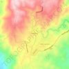
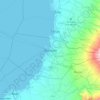
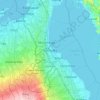
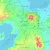
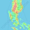
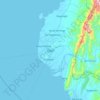
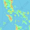
Negros Occidental topographic map

Click on the map to display elevation.

Negros Occidental

Negros Occidental has a tropical climate due to the fact that it is situated close to the equator, being located at least nine degrees north of it. The northern section of the province has a tropical rainforest (Köppen: Af) climate, whereas the southern portion has a tropical monsoon (Köppen: Am) climate. Mount Kanlaon itself, along with its higher-elevated slopes, are classified as having a dry-winter subtropical highland climate (Köppen: Cwb) due to their higher elevations, allowing for a significantly cooler temperature compared to the province as a whole.

Wikipedia (CC-BY-SA 3.0)

About this map

Name: Negros Occidental topographic map, elevation, terrain.

Location: Negros Occidental, Negros Island Region, Philippines (9.33202 122.22791 11.13784 123.70958)

Average elevation: 126 m

Minimum elevation: -2 m

Maximum elevation: 2,356 m

Other topographic maps

Click on a map to view its topography, its elevation and its terrain.
Quezon City

Philippines

Founded as a pueblo by Saint Pedro Bautista in 1590, San Francisco del Monte may be considered Quezon City's oldest district. The original land area of the old town of San Francisco del Monte was approximately2.5 square kilometres (1.0 sq mi) and covered parts of what is currently known as Project 7 and 8 and…

Average elevation: 57 m
Baguio

Philippines

In 1903, Filipinos, Japanese and Chinese workers were hired to build Kennon Road, the first road directly connecting Baguio with the lowlands of La Union and Pangasinan. Before this, the only road to Benguet was Naguilian Road, and it was largely a horse trail at higher elevations. Camp John Hay was…

Average elevation: 881 m
San Juan

Philippines

"San Juan" is a contraction of the city's traditional name of "San Juan del Monte" (lit. 'Saint John of the Mountain'). As with numerous other places in the Philippines, the name combines a patron saint and a toponym; in this case Saint John the Baptist with the locale's hilly terrain and relatively higher…

Average elevation: 35 m
Iligan

Philippines

Average elevation: 229 m

Naguilian

Philippines > La Union

The approximate elevation of the municipality is 165 meters above sea level. It has the ninth highest approximate average elevation among the twenty (20) towns of the province. The portion with the highest elevation is 544 meters above sea level while the lowest is 10 meters. The slopes range from 2–7% in…

Average elevation: 85 m
Rizal

Philippines

Average elevation: 95 m

Manila Bay

Philippines > Cavite

Average elevation: 0 m

Sampaloc

Philippines > Rizal > Tanay

Average elevation: 394 m

Wawa

Philippines > Oriental Mindoro > Calapan

Average elevation: 3 m

Lapu-Lapu

Philippines

Average elevation: 93 m

Malolos

Philippines > Bulacan

Malolos is relatively flat of about 0.81% to a gently sloping of 2.17%. The slope of the land descends towards west, southwest to southern direction. The highest land elevation is at about 6.0 meters above sea level while the lowest is only half a meter below sea level. A network of natural waterways and…

Average elevation: 6 m

Claver

Philippines > Surigao Del Norte

Average elevation: 28 m

Bessie Island

Philippines > Palawan

Average elevation: 0 m

Mandaue

Philippines

It is one of the two (the other one being the municipality of Consolacion) local government units located within the mainland Metro Cebu where the elevation of land is less than 100 m (330 ft).

Average elevation: 109 m
Pili

Philippines > Camarines Sur

Average elevation: 31 m

Bacolod

Philippines

Bacólod (English: Bacolod), is derived from bakólod (Old Spelling: bacólod), the Old Hiligaynon (Old Ilonggo) (Old Spelling: Ylongo and Ilongo) word for a "hill, turtle, mound, rise, hillock, down, any small eminence or elevation", since the resettlement was founded on a stony, hilly area, now the barangay…

Average elevation: 49 m
Parañaque

Philippines

Average elevation: 14 m

Camarines Sur

Philippines

Average elevation: 56 m

Samar

Philippines

Average elevation: 38 m

Masbate

Philippines

Average elevation: 54 m

San Pedro

Philippines > Laguna > San Pedro > San Pedro

Average elevation: 51 m

Sual

Philippines > Pangasinan

Average elevation: 83 m

San Basilio

Philippines > Pampanga > Santa Rita

Average elevation: 36 m

Toong

Philippines > Batangas > Tuy

Average elevation: 471 m

Upper Agno River Basin

Philippines > Benguet

Average elevation: 1,289 m

La Roxas

Philippines > Bukidnon > Maramag

Average elevation: 846 m

Allen

Philippines > Northern Samar

Average elevation: 33 m

Lopez

Philippines > Quezon

Average elevation: 33 m

Calabanga

Philippines > Camarines Sur

The topographic landscape of the municipality could be characterized as generally flat with a slope 0-3%, gently sloping (3-8%) towards the direction of the eastern portion and finally rolling up to higher steeps towards the direction of the south-eastern part going to Mt. Isarog. The 0-3% slope is a broad…

Average elevation: 11 m

Don Carlos

Philippines > Bukidnon > Don Carlos

The terrain of the municipality of Don Carlos is generally flat except the mountain range on the eastern part of the municipality. The highest elevation is 700 metres (2,300 ft) above sea level and the lowest elevation is 300 metres (980 ft) below sea level.

Average elevation: 299 m
Barili

Philippines > Cebu

Average elevation: 81 m

Jaen

Philippines > Nueva Ecija

Average elevation: 20 m

Badian

Philippines > Cebu

Average elevation: 113 m

Tanauan

Philippines > Batangas

Average elevation: 164 m

Kinatihan II

Philippines

Average elevation: 22 m

Dumanjug

Philippines > Cebu

Average elevation: 50 m

Purok Aguinaldo

Philippines > Quezon City

Average elevation: 59 m

Taguig

Philippines

Average elevation: 39 m

Tarlac

Philippines

Average elevation: 109 m

Pasig

Philippines

Average elevation: 46 m

Nueva Ecija

Philippines

Average elevation: 112 m

Cebu

Philippines

Average elevation: 89 m

Santa Cruz

Philippines > Zambales

Average elevation: 9 m

Tayabas

Philippines > Quezon

Average elevation: 246 m

San Fernando

Philippines > La Union

Average elevation: 81 m

Nagcarlan

Philippines > Laguna > Nagcarlan

Average elevation: 227 m

Vigan

Philippines > Ilocos Sur

Vigan is situated in a Quaternary Age sedimentary plain called the Vigan-Bantay Plain which is part of the Ilocos coastal plain. The Vigan-Bantay Plain is bounded on the east by a moderately rugged Miocene sediments consisting of interbedded sandstones and shale to very rugged Meta-volcanics and Meta sediment…

Average elevation: 63 m
Mandaluyong

Philippines

Another claims that the Spaniards named the place based on the report of a navigator named Acapulco, who saw the rolling hills frequently being lashed at by daluyong (“big waves from the sea”). This seems to confirm traditional pre-Hispanic stories that giant waves from the sea would meet the adjoining…

Average elevation: 33 m

Marikina

Philippines

Average elevation: 80 m

Patag Island

Philippines

Average elevation: 0 m

Kota Island

Philippines

Average elevation: 0 m

Lankiam Cay

Philippines

Average elevation: 0 m

Iriga

Philippines

Average elevation: 115 m

Davao Gulf

Philippines

Average elevation: 0 m

Lawak Island

Philippines

Average elevation: 0 m

Malinao

Philippines > Albay

Malinao occupies a narrow stretch of plains hemmed in by Lagonoy Gulf in the east and Mount Malinao on the west. The area is dominated by the mountain ranges of Malinao, with a peak altitude of 1,584 metres (5,197 ft) above sea level. It is 30 kilometres (19 mi) from Legazpi City and 557 kilometres (346 mi)…

Average elevation: 17 m

Jimalalud

Philippines > Negros Oriental

Average elevation: 73 m

Surigao del Sur

Philippines

Average elevation: 274 m

Candaba

Philippines

Average elevation: 6 m

Davao City

Philippines

Average elevation: 65 m

Carlagan

Philippines > Quezon

Average elevation: 3 m

Ibabang Bukal

Philippines

Average elevation: 254 m

Cabatang

Philippines

Average elevation: 335 m

Tag-ugpo

Philippines > Davao de Oro

Average elevation: 951 m

Pinget

Philippines

Average elevation: 1,430 m

Caloocan

Philippines

Average elevation: 81 m

Aurora Hill North Central

Philippines

Average elevation: 1,479 m

Besigan

Philippines

Average elevation: 584 m

Talomo River

Philippines

Average elevation: 201 m

Asin

Philippines

Average elevation: 1,321 m

Catambungan

Philippines

Average elevation: 5 m

Tablas Strait

Philippines

Average elevation: 0 m

Buenavista

Philippines

Average elevation: 112 m

Poliwes

Philippines

Average elevation: 1,397 m
Teodora Alonzo

Philippines

Average elevation: 1,459 m
Manggahan

Philippines

Average elevation: 7 m
Bakakeng Norte

Philippines

Average elevation: 1,379 m

Crossing Bayabas

Philippines

Average elevation: 22 m

Marinduque

Philippines

Average elevation: 54 m

Bakakeng Central

Philippines

Average elevation: 1,412 m

Pacdal

Philippines

Average elevation: 1,448 m

Macasandig

Philippines

Average elevation: 42 m

Batanes

Philippines

Average elevation: 26 m

Mataywanac

Philippines > Batangas > Tuy

Average elevation: 102 m

Nueva Vizcaya

Philippines

Average elevation: 107 m

Antique

Philippines

Average elevation: 46 m

Bohol

Philippines

Average elevation: 116 m

Zone IV

Philippines

Average elevation: 4 m

Albay

Philippines

Average elevation: 48 m

Sorsogon

Philippines

Average elevation: 40 m

Mines View

Philippines

Average elevation: 1,431 m

Bulacan

Philippines

Average elevation: 105 m

City Camp Proper

Philippines

Average elevation: 1,430 m

Palawan

Philippines

Average elevation: 9 m

Valenzuela

Philippines

The highest elevation point is 38 meters (125 ft) above sea level. Having a surface gradient of 0.55% and a gentle slope, hilly landscape is located in the industrial section of the city in Canumay. The average elevation point is 2 meters (6.6 ft) above sea level.

Average elevation: 24 m

Zamboanga del Sur

Philippines

Average elevation: 118 m

Leyte

Philippines

Average elevation: 54 m

Quirino

Philippines

Average elevation: 108 m

Cavite

Philippines

Average elevation: 77 m

Isabela

Philippines

Average elevation: 100 m

Gear up for your next adventure:

🛌Insulated Sleeping Pad - Critical thermal barrier between you and the cold ground
🧭GPS Handheld Device - Reliable GPS navigation for outdoor adventures
🧦Hiking Socks - Moisture-wicking and comfortable socks for long hikes
🥫Freeze-Dried Meals - Lightweight, high-calorie nutrition for multi-day treks
🌬️Windproof Camp Stove - Efficient cooking even on exposed mountain peaks

As an Amazon Associate, this site earns from qualifying purchases at no extra cost to you.