
Thank you for supporting this site ❤️
Make a donation
Make a donation
Gear up for your next adventure:
As an Amazon Associate, this site earns from qualifying purchases at no extra cost to you.
Westhope topographic map
Click on the map to display elevation.
Thank you for supporting this site ❤️
Make a donation
Make a donation
Gear up for your next adventure:
As an Amazon Associate, this site earns from qualifying purchases at no extra cost to you.
About this map
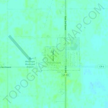
Name: Westhope topographic map, elevation, terrain.
Location: Westhope, Bottineau County, North Dakota, United States (48.90746 -101.02748 48.91569 -101.01086)
Average elevation: 455 m
Minimum elevation: 451 m
Maximum elevation: 459 m
Thank you for supporting this site ❤️
Make a donation
Make a donation
Gear up for your next adventure:
As an Amazon Associate, this site earns from qualifying purchases at no extra cost to you.
Other topographic maps
Click on a map to view its topography, its elevation and its terrain.
Turtle Mountain State Recreational Forest
United States > North Dakota > Bottineau County
Average elevation: 636 m