Geolocate

Cooch Behar topographic map

Click on the map to display elevation.

Cooch Behar

The elevation of the town is 48 meters above mean sea level.

About this map

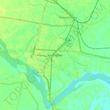
Name: Cooch Behar topographic map, elevation, terrain.

Location: Cooch Behar, Koch Bihār, Kochbihar, West Bengal, 736101, India (26.28237 89.41924 26.36237 89.49924)

Average elevation: 43 m

Minimum elevation: 35 m

Maximum elevation: 49 m

Gear up for your next adventure:

🥾Light Trekking Boots - Supportive boots for multi-day treks
🧣Merino Neck Gaiter - Protects against wind, sun, and cold at high altitudes
🕯️Camping Lantern - Illuminates your entire campsite with high-efficiency LEDs
🧢Sun Protection Cap - Breathable cap to protect from sun exposure
🥾Mountain Hiking Boots - High-traction boots for rocky terrain

As an Amazon Associate, this site earns from qualifying purchases at no extra cost to you.