
Thank you for supporting this site ❤️
Make a donation
Make a donation
Gear up for your next adventure:
As an Amazon Associate, this site earns from qualifying purchases at no extra cost to you.
Yatí topographic map
Click on the map to display elevation.
Thank you for supporting this site ❤️
Make a donation
Make a donation
Gear up for your next adventure:
As an Amazon Associate, this site earns from qualifying purchases at no extra cost to you.
About this map
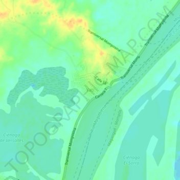
Name: Yatí topographic map, elevation, terrain.
Location: Yatí, Magangué, Mojana, Bolívar, RAP Caribe, Colombia (9.24807 -74.75418 9.28807 -74.71418)
Average elevation: 17 m
Minimum elevation: 7 m
Maximum elevation: 37 m
Thank you for supporting this site ❤️
Make a donation
Make a donation
Gear up for your next adventure:
As an Amazon Associate, this site earns from qualifying purchases at no extra cost to you.