Geolocate

Cereie topographic map

Click on the map to display elevation.

About this map
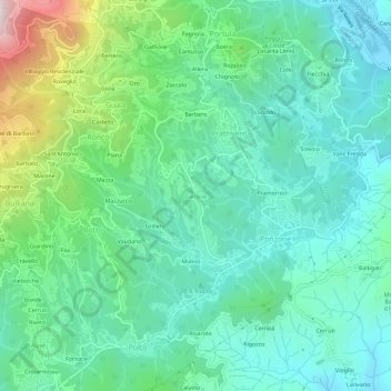
Name: Cereie topographic map, elevation, terrain.

Location: Cereie, Valdilana, Biella, Piemonte, 13835, Italia (45.63867 8.15544 45.67867 8.19544)

Average elevation: 601 m

Minimum elevation: 422 m

Maximum elevation: 1,157 m

Other topographic maps

Click on a map to view its topography, its elevation and its terrain.

Ponderano

Italia > Piemonte > Biella

Average elevation: 341 m

Gifflenga

Italia > Piemonte > Biella

Average elevation: 188 m

Torrazzo

Italia > Piemonte > Biella

Average elevation: 538 m

Gear up for your next adventure:

🧥Thermal Layer - Insulating layer for cold outdoor conditions
🥾Trail Hiking Shoes - Durable shoes designed for rugged trails
🥾Light Hiking Boots - Lightweight and comfortable boots for day hikes
🧳Compression Sacks - Maximize space in your backpack by shrinking gear
🥾Durable Hiking Shoes - Long-lasting shoes for frequent hiking

As an Amazon Associate, this site earns from qualifying purchases at no extra cost to you.