
Morialmé topographic map
Interactive map
Click on the map to display elevation.
About this map
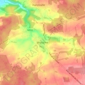
Name: Morialmé topographic map, elevation, terrain.
Average elevation: 256 m
Minimum elevation: 201 m
Maximum elevation: 282 m
Other topographic maps
Click on a map to view its topography, its elevation and its terrain.
Flavion
Belgique > Province de Namur > Philippeville > Florennes
Flavion, Florennes, Philippeville, Province de Namur, Wallonie, 5620, Belgique
Average elevation: 270 m