
Thank you for supporting this site ❤️
Make a donation
Make a donation
Gear up for your next adventure:
As an Amazon Associate, this site earns from qualifying purchases at no extra cost to you.
Rossone topographic map
Click on the map to display elevation.
Thank you for supporting this site ❤️
Make a donation
Make a donation
Gear up for your next adventure:
As an Amazon Associate, this site earns from qualifying purchases at no extra cost to you.
About this map
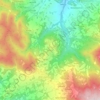
Name: Rossone topographic map, elevation, terrain.
Location: Rossone, Zavattarello, Pavia, Lombardia, 27059, Italia (44.82878 9.22371 44.86878 9.26371)
Average elevation: 678 m
Minimum elevation: 433 m
Maximum elevation: 998 m
Thank you for supporting this site ❤️
Make a donation
Make a donation
Gear up for your next adventure:
As an Amazon Associate, this site earns from qualifying purchases at no extra cost to you.