
Make a donation
Gear up for your next adventure:
As an Amazon Associate, this site earns from qualifying purchases at no extra cost to you.
Skilleard topographic map
Click on the map to display elevation.
Make a donation
Gear up for your next adventure:
As an Amazon Associate, this site earns from qualifying purchases at no extra cost to you.
Skilleard
Schillaard werd in 1445 vermeld als Scallaert, in 1478 als Schillaerdt, in 1482 als Schellart en in 16e en 17e eeuw als Schillaerd. De plaatsnaam zou mogelijk verwijzen naar een terp (werth) bij een schelpenbank (skil-schelp). Een andere mogelijke betekenis is dat de terp/wierde scheef weglopend was, waarbij schil verwant zou zijn aan 'schelling'. Weer een andere mogelijke betekenis wijst naar een bewoonde hoogte op een scheiding (schil).
Make a donation
Gear up for your next adventure:
As an Amazon Associate, this site earns from qualifying purchases at no extra cost to you.
About this map
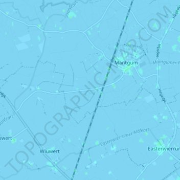
Name: Skilleard topographic map, elevation, terrain.
Average elevation: 0 m
Minimum elevation: -3 m
Maximum elevation: 3 m
Make a donation
Gear up for your next adventure:
As an Amazon Associate, this site earns from qualifying purchases at no extra cost to you.