Geolocate

Corbane topographic map

Click on the map to display elevation.

About this map

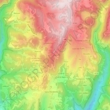
Name: Corbane topographic map, elevation, terrain.

Location: Corbane, Bosco Chiesanuova, Verona, Veneto, 37021, Italy (45.61297 11.01870 45.65297 11.05870)

Average elevation: 1,089 m

Minimum elevation: 773 m

Maximum elevation: 1,346 m

Gear up for your next adventure:

🥾Hiking Boots - Sturdy boots providing ankle support and traction on rugged trails
🔨Vehicle Emergency Tool - Safety tool for remote road trips to trailheads
🥾Trekking Boots - Durable boots for long-distance trekking
🚲Handlebar Phone Mount - View topographic-map.com live while cycling
🛏️Sleeping Bag - Warm and compact sleeping bags for outdoor camping

As an Amazon Associate, this site earns from qualifying purchases at no extra cost to you.