
Thank you for supporting this site ❤️
Make a donation
Make a donation
Gear up for your next adventure:
As an Amazon Associate, this site earns from qualifying purchases at no extra cost to you.
İl topographic map
Click on the map to display elevation.
Thank you for supporting this site ❤️
Make a donation
Make a donation
Gear up for your next adventure:
As an Amazon Associate, this site earns from qualifying purchases at no extra cost to you.
About this map
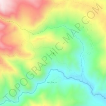
Name: İl topographic map, elevation, terrain.
Location: İl, Keçilioba, Başkale, Van, Eastern Anatolia Region, Turkey (37.85134 43.92331 37.89134 43.96331)
Average elevation: 2,338 m
Minimum elevation: 2,054 m
Maximum elevation: 2,747 m
Thank you for supporting this site ❤️
Make a donation
Make a donation
Gear up for your next adventure:
As an Amazon Associate, this site earns from qualifying purchases at no extra cost to you.