Geolocate

Muttippalam topographic map

Click on the map to display elevation.

About this map

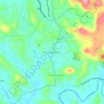
Name: Muttippalam topographic map, elevation, terrain.

Location: Muttippalam, Ernad, Malappuram, Kerala, 676121, India (11.07797 76.09947 11.11797 76.13947)

Average elevation: 55 m

Minimum elevation: 15 m

Maximum elevation: 156 m

Other topographic maps

Click on a map to view its topography, its elevation and its terrain.

Malappuram

India > Kerala > Ernad > Malappuram

Average elevation: 62 m

Irumbuzhi

India > Kerala > Ernad > Malappuram

Average elevation: 43 m

Vandoor

India > Kerala > Ernad

Average elevation: 59 m

Alathurpadi

India > Kerala > Ernad > Malappuram

Average elevation: 64 m

Manjeri

India > Kerala > Ernad

Manjeri is located at 11°07′N 76°07′E / 11.12°N 76.12°E / 11.12; 76.12. It has an average elevation of 38 metres (124 feet) from sea level.

Average elevation: 58 m

Kavanur

India > Kerala > Ernad > Kavanoor

Average elevation: 42 m

Areekkode

India > Kerala > Ernad

Average elevation: 112 m

Malappuram

India > Kerala > Ernad

Average elevation: 56 m

Manjeri

India > Kerala > Ernad

Manjeri is located at 11°07′N 76°07′E / 11.12°N 76.12°E / 11.12; 76.12. It has an average elevation of 38 metres (124 feet) from sea level.

Average elevation: 58 m

Gear up for your next adventure:

🥾Approach Boots - Comfortable boots for hiking and climbing approaches
🧥Fleece Jacket - Warm and lightweight jacket for layering
🧦Crew Hiking Socks - Comfortable socks for long-distance hikes
🦯Trekking Poles - Reduced impact on joints for steep topographic climbs
🧣Merino Neck Gaiter - Protects against wind, sun, and cold at high altitudes

As an Amazon Associate, this site earns from qualifying purchases at no extra cost to you.