
Make a donation
Gear up for your next adventure:
As an Amazon Associate, this site earns from qualifying purchases at no extra cost to you.
Lorica topographic map
Click on the map to display elevation.
Make a donation
Gear up for your next adventure:
As an Amazon Associate, this site earns from qualifying purchases at no extra cost to you.
Lorica
Lorica è una frazione divisa fra i comuni di San Giovanni in Fiore e Casali del Manco, situata nella Sila Grande a un’altitudine di 1314 metri s.l.m.
Make a donation
Gear up for your next adventure:
As an Amazon Associate, this site earns from qualifying purchases at no extra cost to you.
About this map
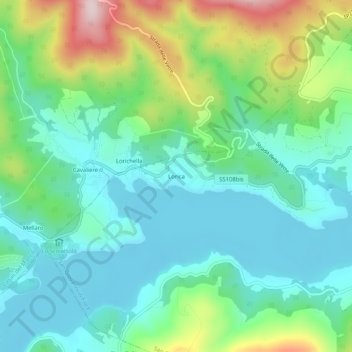
Name: Lorica topographic map, elevation, terrain.
Location: Lorica, San Giovanni in Fiore, Cosenza, Calabria, Italia (39.22983 16.49105 39.26983 16.53105)
Average elevation: 1,370 m
Minimum elevation: 1,273 m
Maximum elevation: 1,626 m
Make a donation
Gear up for your next adventure:
As an Amazon Associate, this site earns from qualifying purchases at no extra cost to you.