Geolocate

Modautal topographic map

Click on the map to display elevation.

About this map

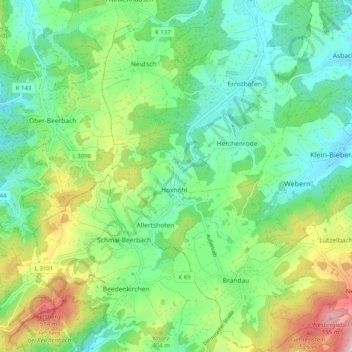
Name: Modautal topographic map, elevation, terrain.

Location: Modautal, Landkreis Darmstadt-Dieburg, Hesse, 64397, Germany (49.72222 8.69977 49.78713 8.79057)

Average elevation: 333 m

Minimum elevation: 195 m

Maximum elevation: 598 m

Gear up for your next adventure:

🥾Trail Hiking Shoes - Durable shoes designed for rugged trails
🛰️Satellite Messenger - Emergency communication for areas with no cell service
🧤Insulated Winter Gloves - Heavy-duty protection for sub-zero Canadian adventures
💡Portable Camping Lamp - Rechargeable lamp for campsite lighting
🧼Biodegradable Camp Soap - Environmentally friendly cleaning for gear and body

As an Amazon Associate, this site earns from qualifying purchases at no extra cost to you.