Geolocate

Fremantle topographic map

Click on the map to display elevation.

About this map

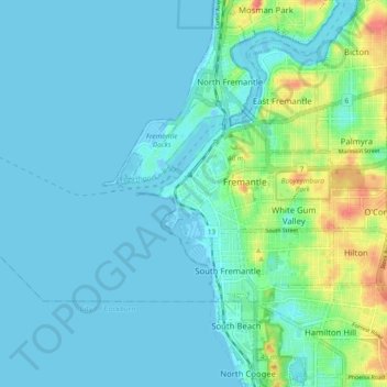
Name: Fremantle topographic map, elevation, terrain.

Location: Fremantle, City of Fremantle, Western Australia, 6959, Australia (-32.09587 115.70617 -32.01587 115.78617)

Average elevation: 11 m

Minimum elevation: -9 m

Maximum elevation: 61 m

Other topographic maps

Click on a map to view its topography, its elevation and its terrain.

Gear up for your next adventure:

🚲Heavy Duty Bike Lock - Secure your bike at the trailhead or during stops
🪜Heavy Duty Carabiners - Multi-use clips for securing gear to your backpack
🧢Outdoor Cap - Protective cap for sun and rain during hikes
🥾Hiking Gaiters - Protect legs and shoes from mud, snow, and debris
🗺️Topographic Maps - Detailed maps to explore trails, mountains, and wilderness areas

As an Amazon Associate, this site earns from qualifying purchases at no extra cost to you.