Geolocate

Sn3 topographic map

Click on the map to display elevation.

About this map

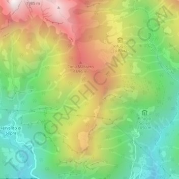
Name: Sn3 topographic map, elevation, terrain.

Location: Sn3, Boccioleto, Vercelli, Piedmont, 13022, Italy (45.83649 8.09005 45.85649 8.11005)

Average elevation: 1,227 m

Minimum elevation: 673 m

Maximum elevation: 1,961 m

Gear up for your next adventure:

🔨Vehicle Emergency Tool - Safety tool for remote road trips to trailheads
🏃Hydration Running Vest - Carry water and maps close to your body for speed
🧢Hiking Sun Hat - Wide-brimmed protection for exposed mountain ridges
🛏️Camping Sleeping Mat - Comfortable mats for sleeping outdoors
🌡️Emergency Mylar Blankets - Compact thermal protection for unexpected nights outdoors

As an Amazon Associate, this site earns from qualifying purchases at no extra cost to you.