Geolocate

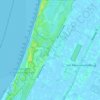
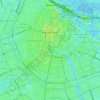
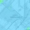
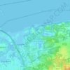
Hilversum topographic map

Click on the map to display elevation.

About this map
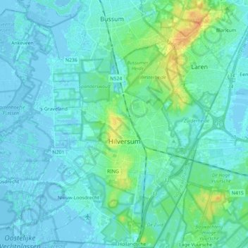
Name: Hilversum topographic map, elevation, terrain.

Location: Hilversum, North Holland, Netherlands (52.17768 5.10201 52.28555 5.21896)

Average elevation: 5 m

Minimum elevation: -4 m

Maximum elevation: 31 m

Other topographic maps

Click on a map to view its topography, its elevation and its terrain.

Catrijp

Netherlands > North Holland > Schoorl

Average elevation: 7 m

De Kooy

Netherlands > North Holland > Den Helder

Average elevation: 0 m

Anna's Berg

Netherlands > North Holland > Hilversum

Average elevation: 6 m

Zaan

Netherlands > North Holland > Zaandam

Average elevation: 2 m

Haarlem

Netherlands > North Holland > Haarlem

Average elevation: 0 m

Spaarndam

Netherlands > North Holland

Average elevation: 0 m

Catrijper Nok

Netherlands > North Holland > Schoorl > Catrijp

Average elevation: 10 m

Centrum

Netherlands > North Holland > Amsterdam

Average elevation: 7 m

Zuid-Haffel

Netherlands > North Holland > Den Burg

Average elevation: 0 m

Tafelberg

Netherlands > North Holland > Huizen

Average elevation: 15 m

Klet

Netherlands > North Holland > Broek op Langedijk

Average elevation: 0 m

Spang

Netherlands > North Holland > De Waal

Average elevation: -1 m

Hoofddorp

Netherlands > North Holland > Hoofddorp > Hoofddorp

Average elevation: -3 m

Strandslag 37

Netherlands > North Holland > Castricum

Average elevation: 4 m

Valkeveen

Netherlands > North Holland > Naarden

Average elevation: 2 m

Catrijp

Netherlands > North Holland > Schoorl

Average elevation: 7 m

Weesp

Netherlands > North Holland > Weesp

Average elevation: 0 m

Sloten

Netherlands > North Holland > Amsterdam

Average elevation: 0 m

Gerbrandypark

Netherlands > North Holland > Amsterdam

Average elevation: 3 m

Friese Buurt

Netherlands > North Holland > Den Helder

Average elevation: 0 m

Winterpark

Netherlands > North Holland > Nieuw-Vennep

Average elevation: -4 m

Bangert

Netherlands > North Holland > Andijk

Average elevation: -2 m

Valkeveen

Netherlands > North Holland > Naarden

Average elevation: 2 m

Gear up for your next adventure:

🔥Camping Stove - Portable stoves to cook outdoors with ease
🥾Light Hiking Boots - Lightweight and comfortable boots for day hikes
🧥Ultralight Puffy Jacket - Maximum warmth that packs down to the size of an orange
🛌Insulated Sleeping Pad - Critical thermal barrier between you and the cold ground
💡Solar Camping Lamp - Eco-friendly lighting for campsites

As an Amazon Associate, this site earns from qualifying purchases at no extra cost to you.