Geolocate

Nagele topographic map

Click on the map to display elevation.

About this map

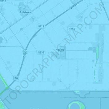
Name: Nagele topographic map, elevation, terrain.

Location: Nagele, Noordoostpolder, Flevoland, Netherlands (52.60756 5.62767 52.67844 5.77530)

Average elevation: -3 m

Minimum elevation: -7 m

Maximum elevation: 6 m

Gear up for your next adventure:

🎒Hiking Daypack - Lightweight and durable backpacks for day trips and excursions
🧥Thermal Fleece Jacket - Versatile insulation for changing mountain temperatures
🥾Trail Running Shoes - Lightweight and durable shoes for trail running
🧰Multitool Knife - Compact and versatile tool for outdoor use
🧥Waterproof Hiking Jacket - Protect yourself from rain and wind while hiking

As an Amazon Associate, this site earns from qualifying purchases at no extra cost to you.