Geolocate

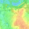
Fourmies topographic map

Click on the map to display elevation.

About this map

Name: Fourmies topographic map, elevation, terrain.

Location: Fourmies, Avesnes-sur-Helpe, Nord, Hauts-de-France, Metropolitan France, 59610, France (49.97978 4.02101 50.03298 4.09793)

Average elevation: 214 m

Minimum elevation: 170 m

Maximum elevation: 247 m

Other topographic maps

Click on a map to view its topography, its elevation and its terrain.
Arenberg

France > Hauts-de-France > Nord > Wallers

Average elevation: 31 m

Mouvaux

France > Hauts-de-France > Nord > Mouvaux > Mouvaux

Average elevation: 35 m

Gear up for your next adventure:

🧢Sun Hat - Wide-brim hat for sun protection
🛌Insulated Sleeping Pad - Critical thermal barrier between you and the cold ground
🥾Light Hiking Boots - Lightweight and comfortable boots for day hikes
💡Portable Camping Lamp - Rechargeable lamp for campsite lighting
🛰️Satellite Messenger - Emergency communication for areas with no cell service

As an Amazon Associate, this site earns from qualifying purchases at no extra cost to you.